HOME ENQUIRIES BOOK MAP LIST FLIGHTS CAR HIRE FOR SALE CONTACT US

HELLO  ITALY    Undiscovered Tuscany

Self-catering   Villas   Houses   Cottages   Apartments     
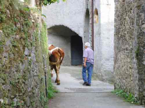
WALKING IN LUNIGIANA
Lunigiana is the ideal area for walking. Gentle strolls across the hills and down to the rivers. More energetic hikes into the Appenines behind, finding the wonderful lakes in the area.

Note that some footpaths may have become overgrown or re-routed. Walking maps can be obtained from the map shop in Licciana-Nardi. You will find it in the village on the left hand side of the main road from Aulla to Licciana. Although we hear that not all the walks turn out as set down!.

Prepare to be flexible, always take water with you and wear appropriate shoes.

VAL Dl TAVERONE

There are many possibilities for anyone who wants to go walking in and around the Taverone valley. The country is a spider's web of paths and mule tracks. Every village has paths leading out to surrounding meadows and woods or on to the next village.

We have selected a few of these walks.

• Baccana to Bastia: Through the countryside by way of the hill tops

• Maesta (Licciana/Tavernelle/Comano fork) to Varano. Short but practical for getting from or to Varano without having to follow the road all the way round.

• Ripola to Apella. Glorious contryside.

• Tavernelle to Cattognano. Over an old humpback bridge and past the ruins of an old mill (start opposite Capriolo Bar in Tavernelle). A pretty walk through the woods.

• Prota to Groppo San Pietro. A very pretty walk connecting two villages high in the mountains.

• Amola to Panicale. Take the track towards Molesana

These are but a few suggestions. There really are hundreds of little paths leading from the villages through woods amidst spectacular scenery. Be adventurous and let us know your favourites. We ask you to respect the countryside and refrain from picking fruit and vegetables from the land, as it is the villager's livelihood.


APENNINES

For the more adventurous there are some splendid mountain excursions, especially up to and on the Tuscan/Emilian Apennine ridge. For these go by car to the Passo del Lagastrello or to Comporaghena (above Comano)

During the summer months and on a nice day you will only need light clothes and walking shoes or trainers, but it would be sensible to carry a sweatshirt or jumper in case the wind gets up. It is also cooler at 1800 metres altitude. Do take water with you and something to eat - not salty food!


CAMPORAGHENA is a small village above Comano. During the war many escaped British prisoners hid in the mountains above Camporaghena. One day the German soldiers approached to capture the British. The parish priest rang the church bells to warn the soldiers in hiding and they consequently made their escape. The priest was shot dead in front of his church by the Germans. There is a plaque to his memory at the front of the church.

Camporaghena is divided into two parts: Top and bottom. When driving into Camporaghena there is a hairpin bend - up is to the top part of the village and down the lane on the right hand side of the bend is the bottom part.

Camporaghena - Torsana: From the top of Camporaghena follow the red and white marks to Torsana, or from Torsana follow the signs to Passo del Cerreto.

Camporaghena - Sassalbo: There are paths both from the top and bottom parts of Camporagheno marked Sassalbo

Camporaghena - Monte Marinella: From the bottom of Camporaghena go straight through the village and follow the red and white signs to Monte Marinella.

Camporaghena - Passo del Cerreto: Take the path to Sassalbo from where you follow the sign to Passo del Cerreto.

Torsana is perched above Comano in the other valley. Torsana- Punta Buffanara: Red and white painted marks indicate this path lading way up to one of the highest peaks of the Apennines (1878 metres) About 5.1/2 hours return not counting rests

Torsana- Passo del Cerreto: The patch down to the right marked Passo del Cerreto leads to Camporaghena and on to Cerreto through Sassalbo


LAGASTRELLO is the old pass connecting Liguria and the North of Tuscany to Parma. If you drive to Lagastrello either from Comano or Tavernelle, at the top you will pass the Lake Paduli on your right. At the end of the lake there is a bridge on your right and at the other side of the bridge a map of the marked Apennine walks reproduced by the Italian Alpine Club.

There are some beautiful drives in the Apennines. One we highly recommend starts at the Passo del Lagastrello which you can reach either by following the road from Tavernelle or by the more picturesque but sinuous road from Comano. This drive takes you right to the Apennines and is extremely picturesque.

Follow the signs: Rigoso, Monchio delle Corte, Passo del Tiocchiano, Corniglio, Bosco Lagdei, Lago Santo, Lagdei, I Lagoni, Valditacca (one report was the road was poor here), Trefiumi, Rigoso, Passo del Lagastrello.

From Lagdei, which is a wild life park surrounded by lovely pine woods, you can take the chair lift up and back to the beautiful Lago Santo. After Lagdei turn right at the Cancelli Foresta Parma (the park exit) towards Lagoni, two interconnecting lakes, Lake Santo and the Lagoni are both set in a particularly beautiful place.
The whole drive is approximately 70 Kms and takes about 3.1/2 hrs not counting stops and the chairlift. There are some superb places to picnic or if preferred try a little Trattoria in one of the villages on the way.

Close this Window


Books & Maps
from Amazon